Kakinada Urban Development Authority boundaries extended

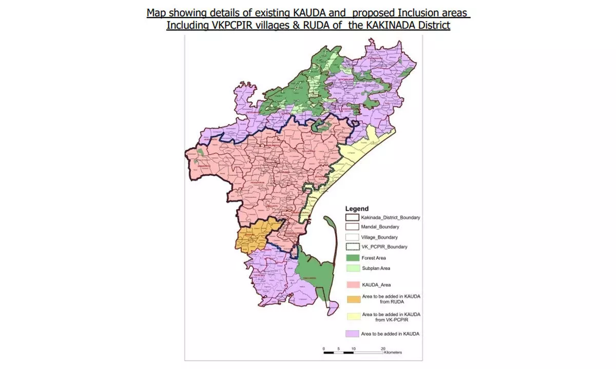
Map showing the details of the existing KUDA and the areas proposed to be included in KUDA, including VKPCPIR villages and RUDA of Kakinada district
Kakinada Urban Development Authority (KUDA) Chairman Ragireddy Chandrakala Deepthi informed that the government had extended the KUDA boundaries.
Kakinada: Kakinada Urban Development Authority (KUDA) Chairman Ragireddy Chandrakala Deepthi informed that the government had extended the KUDA boundaries. The State government had issued GO 181 on November 17, according to which, the boundaries of KUDA have been extended to 2,61,002 sq km with a new addition of 1,373 sq km, she informed.
The chairman said that the KUDA has an extent of 1,373 sq km in 12 mandals and two ULBS duly deleting seven villages of Pedapudi mandal with an extent of 61.25 sq kms from the jurisdiction of Rajamahendravaram Urban Development Authority (RUDA). Now, the total extent of KUDA is 2,61,002 sq kms. Due to the extension of boundaries, technical issues faced by the people in Urban Housing Scheme would be sorted out, she assured.


