After 4 years, El Nino on the horizon

After 4 years, El Nino on the horizon
- Ocean temps are already at record highs, can spell disaster for fish and corals
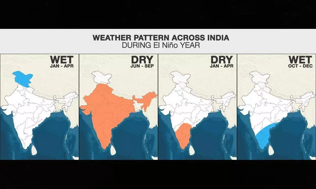
- Below normal rainfall could adversely major crops, giving rise to high inflation
- There have been drought-like situations too due to the phenomenon
Boulder (US): It's coming. Winds are weakening along the equatorial Pacific Ocean. Heat is building beneath the ocean surface. By July, most forecast models agree that the climate system's biggest player – El Niño – will return for the first time in nearly four years. El Nino is one side of the climatic coin called the El Niño-Southern Oscillation, or ENSO. It's the heads to La Niña's tails. During El Niño, a swath of ocean stretching 6,000 miles (about 10,000 kilometres) westward off the coast of Ecuador warms for months on end, typically by 2 to 4 degrees Fahrenheit (about 1 to 2 degrees Celsius). A few degrees may not seem like much, but in that part of the world, it's more than enough to completely reorganise wind, rainfall and temperature patterns all over the planet. I'm a climate scientist who studies the oceans.
After three years of La Niña, it's time to start preparing for what El Niño may have in store. During El Niño, trade winds weaken. Warm water is pushed back east, toward the west coast of the Americas. El Niño means Little Boy in Spanish. South American fishermen first noticed periods of unusually warm water in the Pacific Ocean in the 1600s. The full name they used was El Niño de Navidad, because El Niño typically peaks around December. During El Nino, the waters in the east and central equatorial Pacific experience abnormal warming which is the opposite of La Nina where the region experiences anomalous cooling.
How it affects
No two El Niño events are exactly alike, though we've seen enough of them that forecasters have a pretty good idea of what's likely to happen. People tend to focus on El Niño's impact on land, justifiably. The warm water affects air currents that leave areas wetter or drier than usual. It can ramp up storms in some areas, like the southern US, while tending to tamp down Atlantic hurricane activity. El Niño can also wreak havoc on the many marine ecosystems that support the world's fishing industries, including coral reefs and seagrass meadows.
Marine heat waves
Specifically, El Nino tends to trigger intense and widespread periods of extreme ocean warming known as marine heat waves. Warm water might not seem like a big deal, especially to surfers hoping to leave their wetsuits at home. But for many marine organisms that are highly adapted to specific water temperatures, marine heat waves can make living in the ocean feel like running a marathon. For example, some fish increase their metabolism in warm waters by so much that they burn energy faster than they can eat, and they can die. Pacific cod declined by 70 per cent in the Gulf of Alaska in response to a marine heat wave. Other impacts include bleached corals, widespread harmful algal blooms, decimated seaweeds and increased marine mammal strandings.
The good news is seasonal forecast models can skillfully predict marine heat waves three to six months in advance, depending on the region. And forecasts tend to be most accurate during El Niño years. The same forecasts predict El Niño to ramp up over the next six to nine months, increasing marine heat wave risk in January to March of 2024 for the US West Coast, the western Indian Ocean, the Bay of Bengal, and the tropical North Atlantic. That said, these predictions are far enough out that things could change. Time will tell whether they hold (hot) water, but we would do well to prepare. El Niño is coming.
(The Conversation; Writer is Scientist at National Oceanic and Atmospheric Administration, US)


