Live
- National Birds Day: The vital role of birds in our ecosystem
- Aramghar-Zoo Park flyover to be thrown open to public today
- Punetha named in the list of 50 great persons
- CM to unveil ‘Swarna Kuppam Vision 2029’ in Kuppam today
- Uttarakhand Samaj Meets Governor Jishnu Dev Varma to Launch Temple Foundation Stone Event
- North Andhra was gravely neglected by YSRCP: Lokesh
- Follow time slot for smooth darshan: TTD to devotees
- Dr. Sadguru Dayanidhi Meets Governor Jishnu Dev Varma at Raj Bhavan, Hyderabad
- Ganja, mobile phones traced in Central Jail
- An inspiring journey of an innovative teacher
Just In
Cyclone Fengal Live Update: Tamil Nadu Schools Shut as Storm Strengthens in the Next 24 Hours


Cyclone Fengal is set to intensify within the next 24 hours, bringing heavy rainfall and strong winds to Tamil Nadu and Puducherry. Schools in Tamil Nadu have been closed, and authorities are on high alert as the storm approaches.
The India Meteorological Department (IMD) issued a warning on Thursday about a deep depression over the southwest Bay of Bengal, which is expected to intensify into Cyclone Fengal within the next 12 hours as it moves northwestward.
The cyclone is forecast to make landfall on the northern Tamil Nadu-Puducherry coast between Karaikal and Mahabalipuram on the morning of November 30, bringing wind speeds of 50-70 km/h.
The IMD reported that the deep depression has remained stationary for the past six hours near latitude 9.0° North and longitude 82.1° East, about 100 km east-northeast of Trincomalee. It is expected to move north-northwestwards, skirting the Sri Lankan coast, and intensify into a cyclonic storm in the next 12 hours.
The cyclone is predicted to cross the northern Tamil Nadu-Puducherry coast between Karaikal and Mahabalipuram early on November 30, with winds reaching 50-60 km/h, gusting up to 70 km/h.
S. Kumar, a duty officer at the Visakhapatnam Cyclone Warning Centre, mentioned that the deep depression has moved north-northwestward and is currently located about 550 km south-southeast of Chennai, 370 km southeast of Karaikal, and 470 km southeast of Puducherry.
It is expected to intensify into a cyclonic storm over the next few days, bringing heavy rainfall to the coastal districts of Andhra Pradesh, Tamil Nadu, and Puducherry.
Heavy rainfall is already affecting the region. As a precautionary measure, schools and colleges in Puducherry have been closed. Puducherry’s Education Minister, Arumugam Namassivayam, confirmed that authorities are on high alert.
The Chief Minister’s office reported that the region received 7.5 cm of rain in the past 24 hours, with Karaikal receiving 9.5 cm. The state government has been reviewing its preparedness, and relief operations are underway. Low-lying residents are being relocated to relief camps, and a 24/7 control room is monitoring the situation.
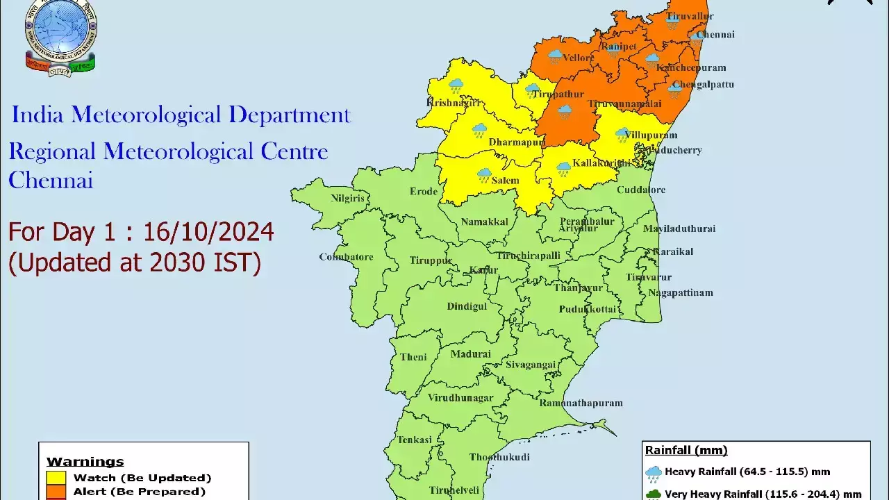
The IMD has forecast heavy rainfall over the next two days for Puducherry, Karaikal, Kancheepuram, Chengalpattu, Villupuram, and Cuddalore, with isolated heavy rainfall in Chennai, Tiruvallur, and nearby districts.
Air travel is also being affected, with airlines issuing advisories about possible disruptions. IndiGo warned passengers to check flight updates due to ongoing bad weather.
Flights to and from Chennai, Tuticorin, Madurai, Tiruchirappalli, and Salem are likely to be impacted. Passengers are urged to remain prepared for delays and monitor the airline’s website for updates.
As the depression moves toward the Tamil Nadu coast, the Indian Coast Guard has heightened its coordination efforts with local authorities to protect seafarers.
Warnings have been issued to fishing boats, advising them to return to harbour to avoid the storm. The Coast Guard’s ships, aircraft, and radar stations are on high alert to provide support if necessary.
With heavy rainfall, strong winds, and possible flooding expected in several districts, residents are advised to stay indoors and follow local advisories.

© 2024 Hyderabad Media House Limited/The Hans India. All rights reserved. Powered by hocalwire.com


