All about Indian monsoon-I


India is an agrarian economy, even after the massive growth of the service sector in the country agricultural economy still holds the major portion in the Gross Domestic Product of nation.
India is an agrarian economy, even after the massive growth of the serv- ice sector in the country agricultural economy still holds the major portion in the Gross Domestic Product of nation.
Agriculture needs a lot of water. Other than Gangetic Plain, which is supplied with ample of water by river Ganga, all the other agricultural regions are dependent on the monsoon. Prominent system Indian Monsoon is the most promi- nent of the world’s monsoon systems,
which primarily affects India and its surrounding water bodies. It blows from the northeast during cooler months and reverses direction to blow from the southwest during the warmest months of the year. This process brings large amounts of rainfall to the region during June and July.
At the Equator the area near India is unique in that dominant or frequent westerly winds occur at the surface al- most constantly throughout the year; the surface easterlies reach only to latitudes near 20° N in February, and even then they have a very strong northerly com- ponent. They soon retreat northward, and drastic changes take place in the up- per-air circulation.
This is a time of transition between the end of one monsoon and the beginning of the next. Late in March the high- sun season reaches the Equator and moves farther north. With it go atmospheric instability, convectional (that is, rising and turbulent) clouds, and rain.
The westerly subtropical jet stream still controls the flow of air across northern India, and the surface winds are north easterlies.Onset, early developments As the high-sun season moves north- ward during April, India becomes particularly prone to rapid heating because the highlands to the north protect it from any incursions of cold air.
There are three distinct areas of relative upper tropospheric warmthnamely, S Above the southern Bay of Bengal, S Above the Plateau of Tibet, and S Across the trunks of the various peninsulas that are relatively dry dur- ing this time.
These three areas combine to form a vast heatsource region. The relatively warm area above the southern Bay of Bengal occurs but may vary according to changes in heating and cooling.) It does not appear at a lower level and is probably caused by the release of condensation heat at the top of towering cumulonimbus clouds along the advancing inter tropical convergence.
In contrast, a heat sink appears over the southern Indian Ocean as the relatively cloud-free air cools by emitting long-wavelength radiation. Monsoon winds at the surface blow from heat sink to heat source. As a result, by May the southwest monsoon is well-established over Sri Lanka.
Also in May, the dry surface of Tibet absorbs and radiates heat that is readily transmitted to the air im- mediately above. At about 6,000 metres an anticyclonic cell arises, causing a strong easterly flow in the upper tropo- sphere above northern India.
The sub tropical jet stream suddenly changes its course to the north of the anticyclonic ridge and the high lands. This change of the upper tropospheric circulation above northern India from westerly jet to easterly flow coincides with a reversal of the vertical temperature and pressure gradients. On many occasions the easterly wind aloft assumes jet force.
It anticipates by a few days the “burst,” or onset, of the surface south westerly monsoon on farther south, with a definite sequential rela- tionship, although the exact cause is not known. Because of India’s inverted triangular shape, the land is heated progressively as the sun moves northward.
This accel- erated spread of heating, combined with the general direction of heat being trans- ported by winds, results in a greater ini- tial monsoonal activity over the Arabian Sea (at late springtime), where a real frontal situation often occurs, than over the Bay of Bengal. The relative humidity of coastal districts in the Indian region rises above 70 per cent, and some rain occurs.
Above the heated land, the air below becomes unstable, but it is held down by the overriding easterly flow. This does not prevent frequent thunder storms from occurring in late May. Peak period During June the easterly jet becomes firmly established. It reaches its greatest speed at its normal position to the south of the anticyclonic ridge from China through India.
In Arabia it decelerates and descends to the middle troposphere. A stratospheric belt of very cold air, analogous to the one normally found above the intertropical convergence near the Equator, occurs above the an- ticyclonic ridge, across southern Asia.
These upper-air features that arise so far away from the Equator are associated with the surface monsoon and are absent when there is no monsoonal flow.
The position of the easterly jet controls the location of monsoonal rains, which oc- cur ahead and to the left of the strongest winds and also behind them and to the right.
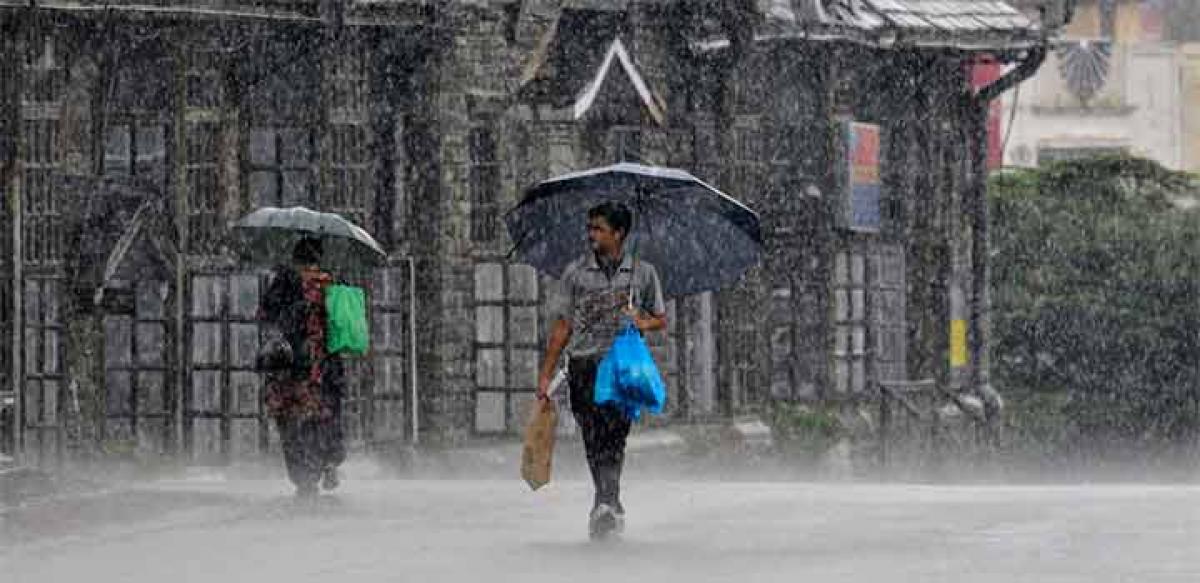
The surface flow, however, is a strong, southwesterly, humid, and un- stable wind that brings humidities of more than 80 percent and heavy squally showers that are the “burst” of the mon- soon.
The overall pattern of the advance follows a frontal alignment, but local episodes may differ considerably. The amount of rain is variable from year to year and place to place. Most spectacular clouds and rain oc- cur against the Western Ghats in India, where the early monsoonal airstream piles up against the steep slopes, then recedes, and piles up again to a greater height.
Each time it pushes thicker clouds upward until wind and clouds roll over the barrier and, after a few brief spells of absorption by the dry inland air, cascade toward the interior. The windward slopes receive 2,000 to 5,000 mm of rain in the monsoon season.
Various factors, especially topogra- phy, combine to make up a complex re- gional pattern. Oceanic air flowing to- ward India below is deflected in accordance with the Coriolis affect.
The converging moist oncoming stream be- comes unstable over the hot land and is subject to rapid convection. Towering cumulonimbus clouds rise thousands of metres, producing violent thunder- storms and releasing latent heat in the surrounding air.
As a result, the upper tropospheric warm belt migrates north- westward from the ocean to the land. The main body of air above 9,000 metres maintains a strong easterly flow. Later, in June and July, the monsoon is strong and well-established to a height of 6,000 metres with occasional thickening to 9,000 metres.
Weather conditions are cloudy, warm, and moist all over India. On the southern slopes of the Khasi Hills where the moist airstreams are lifted and overturned, the village of Cherrapunji in Meghalaya state receives an average rainfall of 2,730 mm in July, with record totals of 897 mm in 24 hours in July 1915, more than 9,000 mm (354 inches) in July 1861, and 16,305 mm (642 inches) in the monsoon season of 1899.
Over the Ganges valley the monsoon, deflected by the Himalayan barrier, be- comes a southeasterly air flow. By then the upper tropospheric belt of warmth from condensation has moved above northern India, with an oblique bias. The lowest pressures prevail at the sur- face.
It is mainly in July and August that waves of low pressure appear in the body of monsoonal air. Fully devel- oped depressions appear once or twice per month. They travel from east to west more or less concurrently with high-level easterly waves and bursts of speed from the easterly jet, causing a local strengthening of the low-level monsoonal flow.
The rainfall conse- quently increases and is much more evenly distributed than it was in June. Some of the deeper depressions be- come tropical cyclones before they reach the land, and these bring torren- tial rains and disastrous floods.
A totally different development arises when the easterly jet moves far- ther north than usual. The monsoonal wind rising over the southern slopes of the Himalayas brings heavy rains and local floods. The weather over the cen- tral and southern districts, however, becomes suddenly drier and remains so for as long as the abnormal shift lasts.
The opposite shift is also possible, with mid latitude upper air flowing along the south face of the Himalayas and bringing drought to the northern districts. Such dry spells are known as “breaks” of the monsoon. Those affect- ing the south of India are similar to those experienced on the Guinea Coast during extreme northward shifts of the wind belts, whereas those affecting the north are due to an interaction of the middle and low latitudes.
The south- west monsoon over the lower Indus plain is only 500 metres thick and does not hold enough moisture to bring rain. On the other hand, the upper tropos- pheric easterlies become stronger and constitute a true easterly jet stream. Western Pakistan, Iran, and Arabia re- main dry and thus become the new source of surface heat.


