Sino-Indian border

Sino-Indian border
x
Highlights

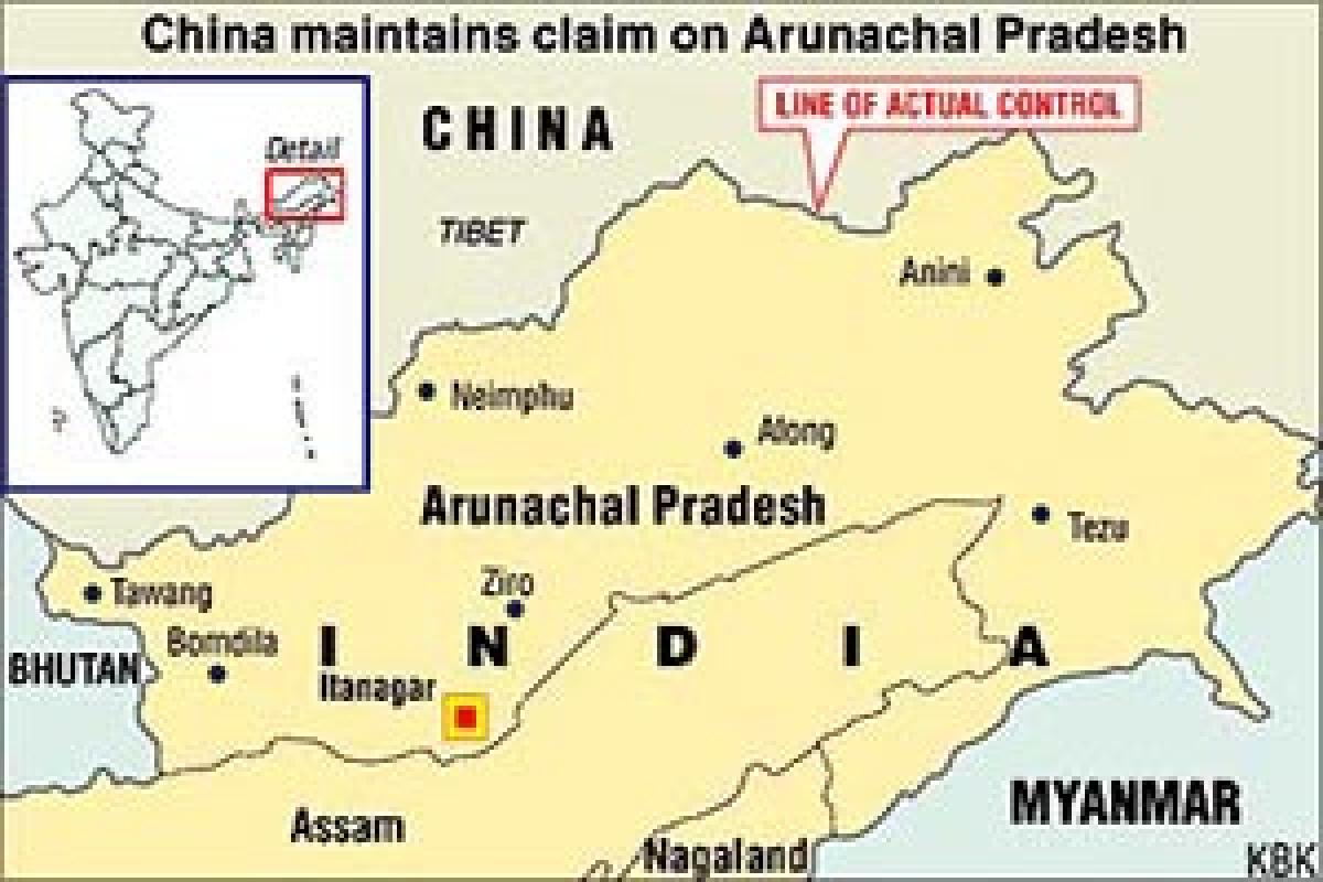
There have been no instances of incursions along our border with China.  However, as there is no commonly delineated Line of Actual Control (LAC) between India and China, there are areas along the border where India and China have differing perception of LAC.

There have been no instances of incursions along our border with China. However, as there is no commonly delineated Line of Actual Control (LAC) between India and China, there are areas along the border where India and China have differing perception of LAC. Due to both sides undertaking patrolling upto their perception of the LAC, transgressions do occur.

To resolve such issues, there is a well established mechanism of Border Personnel Meetings (BPMs), flag meetings, Working Mechanism for Consultation and Coordination (WMCC) and diplomatic channels wherein they are guided by provisions of various agreements between India and China.

The McMahon Line was agreed to by Britain and Tibet as part of the Simla Accord, a treaty signed in 1914. The line is named after Sir Henry McMahon, foreign secretary of the British-run Government of India and the chief negotiator of the convention at Simla. It extends for 550 miles (890 km) from Bhutan in the west to 160 miles (260 km) east of the great bend of the Brahmaputra River in the east, largely along the crest of the Himalayas.

Simla (along with the McMahon Line) was initially rejected by the Government of India as incompatible with the 1907 Anglo-Russian Convention. This convention was denounced in 1921. After Simla, the McMahon Line was forgotten until 1935, when British civil service officer Olaf Caroe convinced the government to publish the Simla Convention and use the McMahon Line on official maps.

As recently as 2003, the Dalai Lama said that the disputed region was part of Tibet, but he reversed his position in 2008, acknowledging the legitimacy of the McMahon Line and the Indian claim to the region. China rejects the Simla Accord, contending that the Tibetan government was not sovereign and therefore did not have the power to conclude treaties.

Chinese maps show some 65,000 square kilometres (25,000 sq mi) of the territory south of the line as part of the Tibet Autonomous Region, known as South Tibet in China. Chinese forces briefly occupied this area during the Sino-Indian War of 1962, writes Wikipedia.

Show Full Article
Print Article
Next Story
More Stories
ADVERTISEMENT
ADVERTISEMENTS