Ooh…lala…Ooty at 200
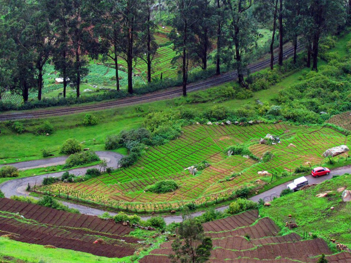
Ooty or Udakamandalam had a long history of sparse human inhabitance Earlier called as Todamala in the Mysore State records, which indicates a hilly terrain Mala like Tirumala or Sabarimala as in vogue among people since millennia
Ooty or Udakamandalam had a long history of sparse human inhabitance. Earlier called as ‘Todamala’ in the Mysore State records, which indicates a hilly terrain (Mala – like Tirumala or Sabarimala as in vogue among people since millennia).
Though, its first touch with civilisation was started around 1818, with the hot pursuit of an erring Polygar (local chieftain) by two British officers, Whish, and Kindersley, who were assistants to the collector, very beginnings of the mention of the place in European records date back to 1602-1603 from an abstract from a Portuguese manuscript, now held by the British Museum.
In colonel Mackenzie records, the area in 1816 was described in detail. “I have put up in the case, for transmission to Europe, a map of the Nilgiris mountains in the district of Danaikencotta, in the Coimbatore province, on the original scale of the survey, of one mile to an inch.
I have selected this as an original specimen, of the work of the native assistant surveyors, and of the survey of a singular tract, of mountainous country situated centrally in the limits between the countries of Malabar, Mysore and Coimbatore, remarkable for their extraordinary height, and for being inhabited by two singular tribes of people described to be dissimilar to the natives of other provinces in habits, manners, language and complexion.
Some notices of whom are communicated in the memoirs of the Mysore Survey sent home in 1808, and in Colonel Wilk’s ‘History of Mysore’. This tract contains 495 miles of mountains and 250 of plain country, altogether 745 miles” (page 3 of ‘Ootacamund: A History’, published in 1908 by Govt of Madras – by Sir Frederik Price).
About the name of the place one version says that Hottegamund, the first name of the region denotes as - Hotte means one house and mund means hill. This southern region is not foreign to names in Sanskrit in the ancient times like Kanchi, Madurai, and Chidambaram etc., and this hilly terrain full of cool climate and pleasant rainfall is fittingly called as Udaka (water) Mandalam (region). Mostly pronounced by the locals as Udhagamandalam. This was the name corrupted by Europeans as Ottacamund, which is now Ooty.
The development of Ooty should credited to British for making these hills inhabitable starting from 1818. For they made hilltop residences, churches, libraries, government houses etc, thus improving the connectivity from the plains to the Nilgiris. James Sullivan, Collector purchased a hundred acres from the Todas, at a price of Rs 1 per acre in 1822. He built the house called ‘Stone House’, in a year, and at that solitary house, the first baptism of his son was performed on May 22, 1823. The Stone House is called by the locals as the Kol Bungalow (Kol means stone) even now, though it was turned into a museum.
With the Stone House partly turning into Sick officers’ quarters, now the cemetery cannot be lagging behind. Thus, the cemetery was marked in the north-east within the hundred acres purchased by Sullivan, and the first British person to be buried here was Cornet H Harrington, of 7th Light cavalry, aged 18, who died here. While Sullivan, appears to be the first real estate developer in the Nilgiri hills, the slow access to colonial establishment had seen the visits of higher-ups of the Government in the decades that followed.
Visiting Nilgiri Hills, partly for health reasons, via Madras where he had official duties related to Vizianagaram Estate, famous Telugu poet Gurajada Apparao, wrote Nilgiri songs, in 1908 and in these six songs sang the glory of the Blue Hills. The Udakamandalam he saw and captured goes like this in the first song.
“Beautiful are the blue hills, their beauty gladdens the heart, verily this is the garden of the gods, and gods and sages love to roam here.” In another song, he starts with a befitting encomium – “Listen, friend, how can I describe the wonders of Ooty… Ooty has no equal, heaven itself is inferior.”


