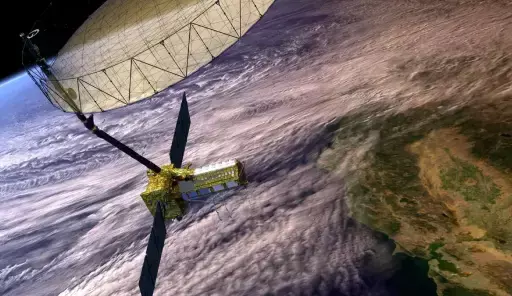
NASA and ISRO's New NISAR Satellite to Track Changes on Earth's Surface

Discover how NASA and ISRO's NISAR satellite will transform Earth monitoring by tracking changes in the planet's surface. Learn about its cutting-edge technology and impact on understanding natural events, climate, and environmental shifts.
NISAR is a joint satellite between ISRO and NASA, ready for launch in early 2025 to monitor our planet's surface on land and ice-covered regions.
The Indian Space and Research Organisation (ISRO) is about to launch a satellite which will allow us to get even better tracking of surface motions down to fractions of an inch on Earth. Grounded on a partnership between NASA and ISRO, the new satellite named NISAR (NASA-ISRO Synthetic Aperture Radar) can allow people to follow different glaciers, ice sheets, and sea ice, as well as the transformation of vegetation across our planet.
NISAR will map the motion of land and ice-covered surfaces across the entire planet every 12 days, providing a new level of understanding of changes occurring on our planet's surface (NASA's Jet Propulsion Laboratory). NASA is a partner, along with ISRO, in creating these two radars, L-band and S-band, which achieve a level of accuracy near zero.
According to the US Space Agency, these instruments allow the satellite to take measurements at all times of day and even be able to see through clouds using the ability of the so-called L-band frequency range (not only that but also deep inside foliage for some applications) to penetrate a number of materials in order for us to measure how much motion occurs on our ground.
NISAR will accurately detect and assess tectonic activity, but it won't be able to predict earthquakes. In California, for example, satellites will allow scientists to go home to where an earthquake may occur, according to NASA. It can find new potential earthquake regions in well-monitored areas.
We are especially looking at the Himalayas plate boundary from an ISRO perspective. NISAR will provide us with never before seen observations to better understand and model the seismic hazard of this part of the Himalayas, an area that has hosted large magnitude earthquakes in the past," said Sreejith K M, ISRO's lead for Solid Earth science for NISAR at Space Applications Center, Ahmedabad.
For volcanologists, NISAR will not only help with the detection of precursory land movements but also give us a view of why volcanoes deform in general and whether this can be related to eruption. The satellite will also monitor Earth's land surface; therefore, it could also be used to monitor e.g. levees, aqueducts and dams, as well as their responses to earthquakes over time.


